Lost in Ripollés
On a Friday afternoon in August a colleague of mine came to my cubicle to ask me for some hiking advice. I gave him some pointers and went back to work. I had not worked for long when I felt a weird sensation in my toes. They were all jittery and eager to move. I realized that I had to go hiking that weekend.
I went online and looked for a last-minute accommodation in the Ribes de Freser area. After a short hunt, I found an attractive and decent priced hotel in Campdevànol. I booked it and went out to buy a map of the area — in the hope that there were some nice hiking routes in the vicinity of the town.
Day 1: Sant Pere d’Aüira
See: Sant Pere d’Aüira
Day 2: Sant Julià de Saltor
I checked out of my hotel at 8am on Sunday morning and headed straight for the mountains. Today, I decided to explore the area east of the river Freser. I had several options in mind that would make a nice hike. The one I fancied the most was to hike up to a mountain called Sant Amand. As all options included a hike up to Sant Julià de Saltor I decided to wait with any decision until that point.
The hike went through the forest north-east of Campdevànol. The first landmark reached was the church of Sant Grau which is sitting on a fairly steep hill-top. The hike there was not physically difficult but rather tricky to navigate. The marked path went through the forest and was frequently intercepted by other paths. I had to hold back of my usual daydreaming in order to focus on spotting the yellow lines painted on tree trunks and stones. At Sant Grau I had to walk around the church a couple of times before finding correct continuation of the path.
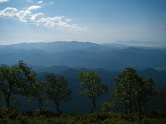
The hike from Sant Grau to Sant Julià de Saltor was relatively easy. Again, the trickiest part was to stay on the right path. Other that that, the hike was mostly about trotting on and enjoying the view — which was pretty spectacular in places. I was pretty pleased with my navigation as I only had made a few minor detours caused by not keeping my eyes on the signs all the time.
I arrived at Sant Julià de Saltor after about 2 hours and 20 minutes of hiking. After consulting a map and admitting that it was getting warm, I decided to take a rain-check — or rather a burning-hot-August-sun-check — on the hike up to Sant Amand. Instead, I decided to head back to Campdevànol.
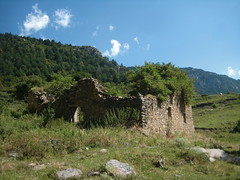
After consuming some fruits and a short exploration of the ruins at Sant Julià de Saltor it was time to continue the hike. All I had to do now was to find the right path to take me back to Campdevànol. For the sake of diversity I decided to take a different path down than the one that brought me up here. In hindsight, I am glad that finding the right path was all I had to do. That task was hard enough.
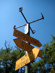
I consulted my map and located the approximate whereabouts of the path. After a lot of skimming I spotted a signpost. I had found a point on the right path. Now I had only to find its continuation. I tried a few candidate paths but none of showed any sign of being the right one. On one of those erroneous paths I came across a skeleton of a cow. I could not help wondering if it had also been trying — in vein — to find the right path. After several unsuccessful trial an error attempts I came across a wide and clearly marked path. I was on the highway down to Campdevànol.
I almost ran down the highway. I was so glad to be finally back on the right track. And what a nice wide track it was. After a while I started wondering why I had not seen a yellow mark for some time. Was the path so wide and clear that it was not worth marking it? Maybe. If the right path had diverted from the wide path, would it not have been marked clearly? Surely. I continued.
Along came a clearing in the forest. I looked for a sign telling me how to continue. I found nothing. I wandered around the clearing, staring at every tree-trunk in the search for a yellow stripe. No stripe was to be seen. I started to realize that the lack of signs on the wide path was probably not due to the sign-makers avoidance of stating the obvious.
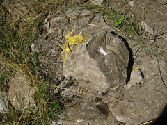
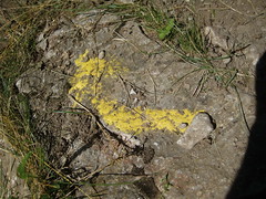
There was only one sensible thing to do. I had to backtrack along the wide path until I found a yellow sign. So I did. After backtracking for quite a while I found what I was looking for — a yellow stripe telling me I was on the right path. I looked at the path and surrounding trees in search of hints about how to continue. At first sight I saw nothing. Then I spotted something that raised my eyebrows. Was that paint coming from under that rock? I lifted the rock and a big yellow arrow emerged. The arrow pointed to the right. I looked to the right. Voilà. On the right was a narrow path leading into the dense forest. Previously I had missed it because the arrow was hidden under the rock.
Again, I was on the right track. I could march on. Carefully though. The forest was again full of crisscrossing paths and this time I wanted to make sure I followed the right one. I succeeded in that task — more or less — and arrived back in Campdevànol at two pm — six hours after I started the hike.
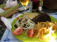
Once in the town I looked for a place where I could recover some of the calories I had lost during the morning hike. I found a nice looking terrace in a side street off Carrer Major. I asked the waitress what they had for lunch. She said she did not know but went to get her mother. Her mother came and started listing the options. A steak, salad, potatoes, egg … Not knowing whether the list was meant to be separated with ANDs, ORs or XORs I just nodded my head. That would do. And along came a steak with salad, potatoes and an egg.
With a full stomach and plenty of energy to tackle the upcoming working week, I headed for the train station and caught the train back to Barcelona. A very nice weekend of hiking was behind me.
